Categories
Past Trip Reports

TripReport – Luye, Taiwan

This is a trip/site report for Luye, Taiwan, by Boris Smolinski

Description

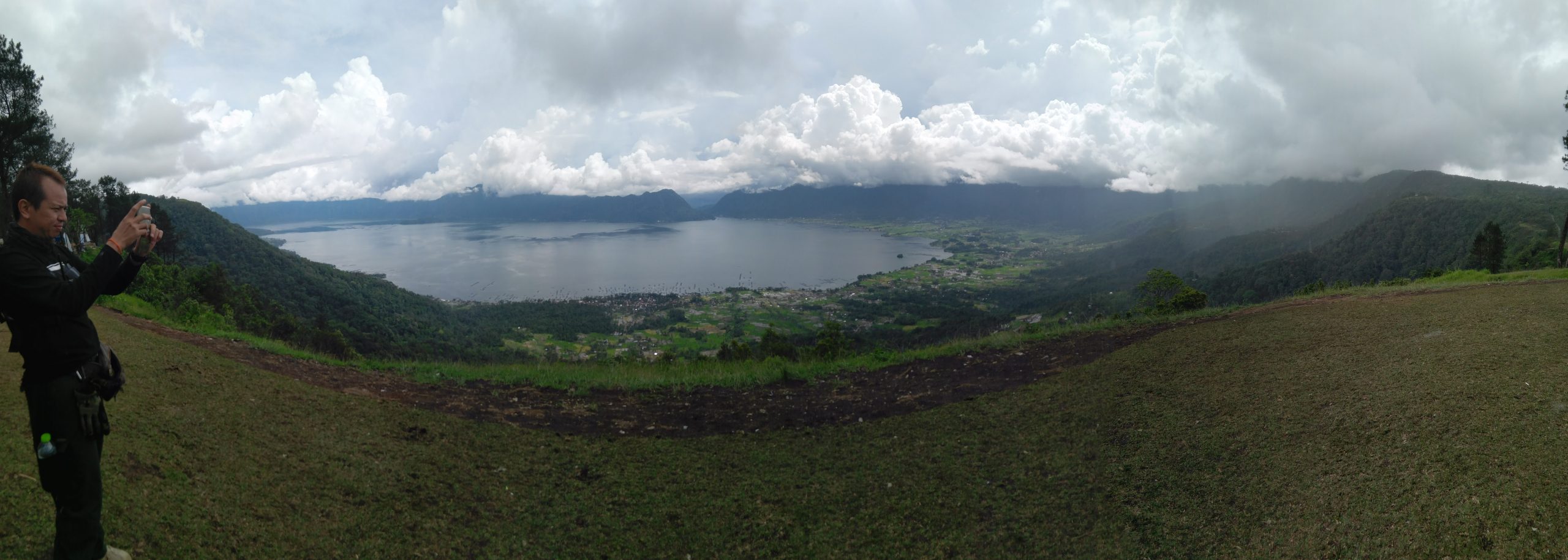
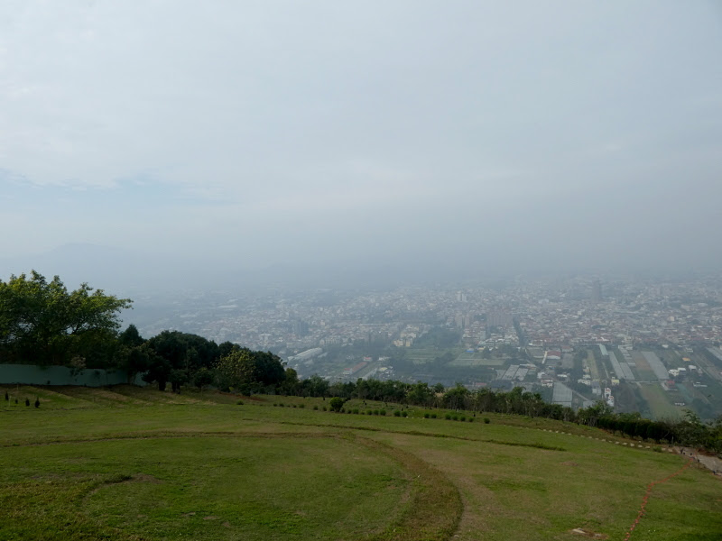
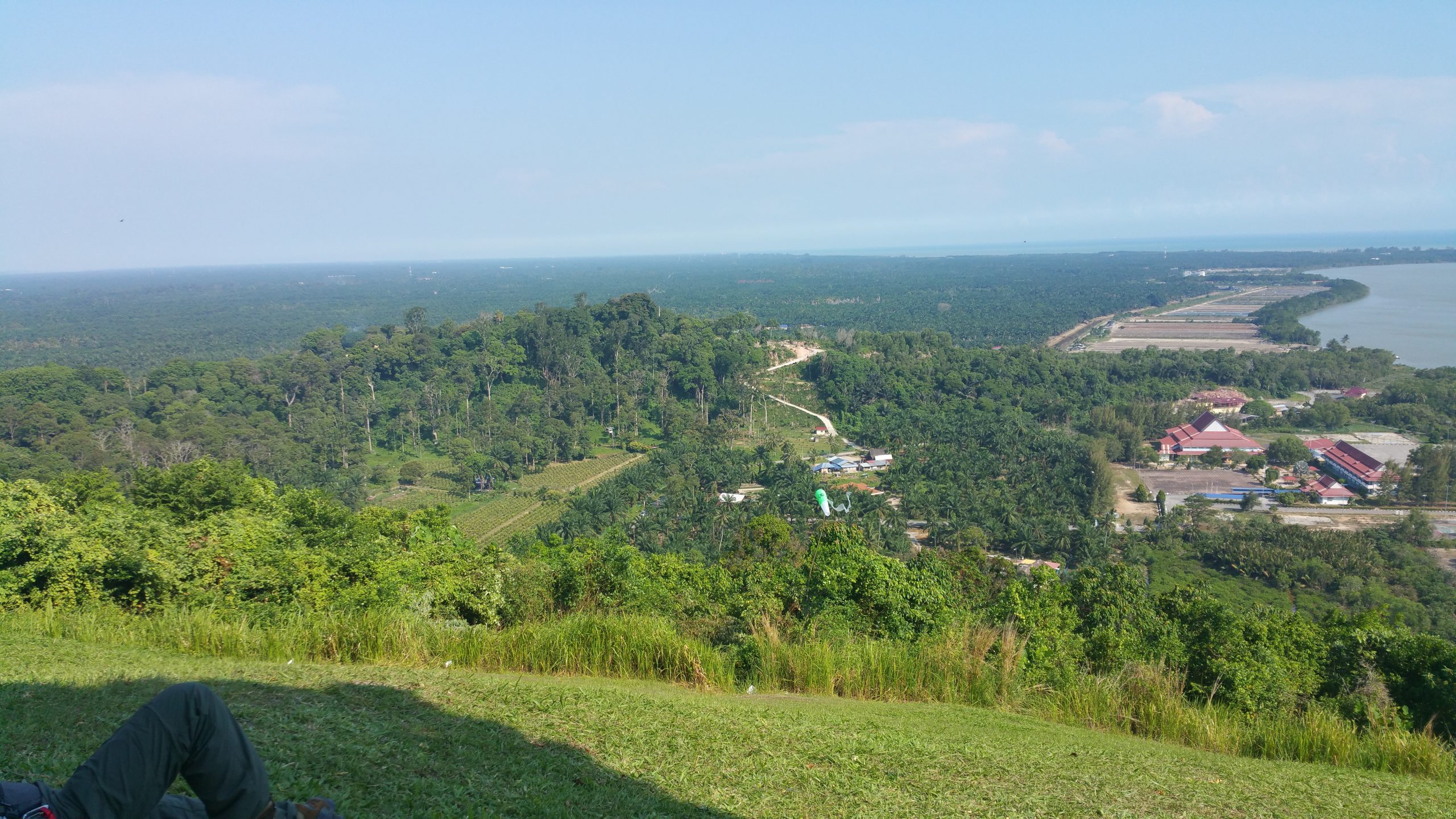
The base of the paragliding community is on Luye Highlands, a hill with a flattish top, large enough for ample paragliding landing space and host to the Hot Air Balloon festival that takes place here during end of September / beginning of August.

The main season is from May until October. The other months experience strong winds which are not suitable for paragliding. There’s a good XC potential with higher hills directly west of the main takeoff. The paragliding season coincides with Typhoon season which will likely lead to a few non-flying days due to high winds and rain.

The lower takeoffs are only used with a southernly winds, which allow to soar the Luye Highlands ridge.

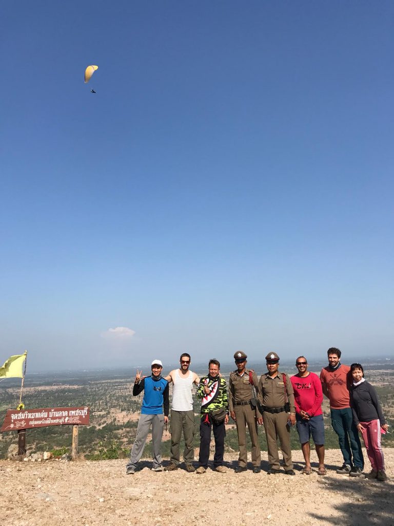
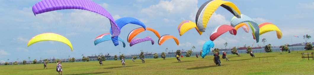
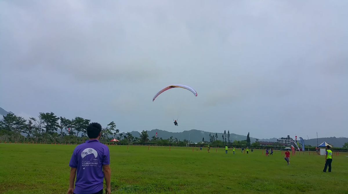
There’s a professional tandem paragliding outfit stationed on Luye Highlands. Reach out to them for information on the area. Rides up to Luye Highland to Taiping San cost TWD 200. Make sure to bring proof of your paragliding license, mine was checked thoroughly.

The locals want you to take a radio on your flight. They use frequency 145.960 MHz. In principle, you’ll need a Taiwan radio license to use a radio.

Other Details

Luye Paragliding Map

Contacts

Soar Paragliding
Contact Numbers: +886939551390, +8860935735669, +886963289908
Map Number: 6
Coordinates: 22.914832, 121.121572
Waypoint: https://goo.gl/maps/tMWpfwa5DXzwKxdM6

Takeoffs

Name: Taiping San
Altitude: 900 m AMSL
Takeoff Directions: N, NE, E, SE, S
Difficulty: Easy
Map Number: 1
Coordinates: 22.928337, 121.100151
Waypoint: https://goo.gl/maps/pSKHRoj9pHa9pwP9A
Comments: Ride from Luye Highlands cost TWD 200 with the local tandem pilots. Toplanding possible.

Name: Luye SW
Altitude: 350 m AMSL
Takeoff Directions: SW
Difficulty: Medium (easy with good wind)
Map Number: 2
Coordinates: 22.913089, 121.118998
Waypoint: https://goo.gl/maps/tRoxc55AiDxxupt78

Name: Luye SE
Altitude: 350 m AMSL
Takeoff Directions: S, SE
Difficulty: Medium (easy with good wind)
Map Number: 3
Coordinates: 22.912763, 121.119902
Waypoint: https://goo.gl/maps/on6vzHVx82kzcUuZ6

Landings

Name: Luye Highlands
Altitude: 350 m AMSL
Landing directions: 360°
Difficulty: Easy
Map Number: 4
Coordinates: 22.915250, 121.120617
Waypoint: https://goo.gl/maps/W9P37o1cn7HFyJeJ6
Comments: Landing on the highland will leave you in no significant lee situations. The ground is gently sloped, but nothing to be alarmed about. The landing is right next to the Tandem Paragliding business. There are restaurants and coffee shops nearby for a snack.

Name: Longtian Village
Altitude: 200 m AMSL
Landing Directions: S, SW, W, NW, N
Difficulty: Easy
Map Number: 5
Coordinates: 22.907891, 121.119272
Waypoint: https://goo.gl/maps/QrJSNQnCLUHXxdVh6
Comments: While landing in E direction is in principle possible, it is less recommended as an E-Wind will likely lead to turbulences on this landing field.

Categories
Past Trip Reports

TripReport – Khao Den, Thailand

This is a trip/site report for Khao Den, Phetchaburi, Thailand

Description

Site Description:

Khao Dan is situated in Kaeng Krachan National Park within Phechaburi province (168km south west). Launch site is about 300m (AGL), with laminal wind from Gulf of Thailand (heated by agriculture land).   Site is part of long ridge line that spreads more than 10km north wards, with XC well above 100km recorded in this site.  Note that Take off/Landing is still about 45mins from Petchaburi town and LZ is marked out by Thailand state flag, whilst TO is with some discarded pagodas. 4WD is required to access TO. Note low gap north wards of Take Off creates strong venturi and pilots are reported to loose height in this zone.  Same effect applies for landing approach.  Best season to fly is between Feb till March.

TO Site Coordinates: Address: ตำบล ห้วยข้อง อำเภอ บ้านลาด เพชรบุรี 76150 (Thai). Huai Khong, Ban Lat District, Phetchaburi 76150, Thailand https://goo.gl/maps/3F4ZKGHJRhK2

Other Details

Best Time to go:

February to March – XC-able. However cloud base could be low (1,500m).

Go & Return

Bus Hire: Transport to Khao Dan from Suvarnabhumi airport. One-way (sits 11 pax cost about THB 4,000). Contact (via LINE: รชดดรนล ID).

Self-Drive: Relatively straight forward. Just travel west via route 35 and turn south to Hwy 4. Takes about 2-3 hours (traffic congestion around BKK area)

Landing Zone:

There are sporadic trees with strong bubbles in LZ making it challenging to land at times (especially during mid-day).  Many trees have thorns and bees.

LZ Site Coordinates: LAT: 13.0379505. LON: 99.80624      Address: Huai Khong, Ban Lat District, Phetchaburi 76150, Thailand. https://goo.gl/maps/yKfFkpay6mp. Tel: +66 85 214 6354

Air Space

Hua Hin Airport with CTR is located 70km south of launch site.

Site Coordinator/Retrieve: Sarapee’s Address:

  • Sarapee Montong (Contact via FB Messenger)

13°03’17.3″N 99°54’50.3″E

https://goo.gl/maps/HPEARK7wuUwaZ1yM8

Sarapee’s house also has two rooms for rental. (Including 5 beds for Thai Massage)

XC and Retrieve

During Feb/March, there are many forest fires and these could be good thermal source.  There are also ample XC landing options, but be wary of green pineapple plantation northwards. There are regular bus service along Hwy 4 (takes about B40 per person to return).  Option to hitch hike to highway and return via bus (remember to pay a token fee for appreciation)..  Bus will reach central bus station in Petchaburi.  Option to walk back to hotel or take tuk tuk.

Lodging

  • Swiss Palazzo   Clean boutique hotel with balcony (careful of monkey opening the door).  Friendly host. Only has 4 rooms so must book early. Can book via Agoda. (SGD50 include breakfast for two). Tel: +66 32 400 250Address: Khlong Kra Saeng, Mueang Phetchaburi District, Phetchaburi 76000, Thailandhttps://goo.gl/maps/yen2kHPG5Zn
  • Royal Diamond  Biggest hotel in region  but rather shabby.  Thai open air beer garden could be noisy.
  • Sun Hotel. Quiet. But a bit old.

                (Careful of hotel along highway. Could be noisy at night).

Getting Around

Cheap option to rent a scooter (B250 per day). Rental from JJ Home  (+66 81 880 9286). 69 Khlong Krachaeng Rd, Tambon Khlong Kra Saeng, Amphoe Mueang Phetchaburi, Chang Wat Phetchaburi 76000, Thailand

Taxi (Tuk Tuk) – 0892127171

R&R. Massage:

Many available. But note most close early at 8-9pm.  Look for Kee Ree for quality and clean massage. (Highly recommended)

Kee Ree Massage เขาวัง รถรางไฟฟ้าเคเบิลคาร์ Khlong Krachaeng Rd, Tambon Khlong Kra Saeng, เมือง Chang Wat Phetchaburi 76000, Thailand+66 88 757 0282https://goo.gl/maps/PyZHxFjEJ8o

Emergency Contact Number:

  • Ambulance (Emergency): 1669
  • Law Enforcement (Royal Thai): 191
  • Law Enforcement (Tourist): 1155
  • Petcharat Hospital: +66 32 417 070. Address: Ban Mo, Mueang Phetchaburi District, Phetchaburi 76000, Thailand
  • Bangkok Hospital Phechaburi: +66 32 897 888. Address: เพชรเกษม 150 ม.6 Ton Mamuang, Mueang Phetchaburi District, Phetchaburi 76000, Thailand

Categories
Past Trip Reports

TripReport – Maninjau

This is a trip/site report for Maninjau, Sumatra, Indonesia

Description

Maninjau is for sure one of the most beautiful places for paragliding in the region of South East Asia. Flying there ranges from soaring, over thermal flying and also some good XC flying along the edges of the big caldera in which this site is situated. Having a stunning view over lake Maninjau, rice terraces in all different colors as well as towards the Indian ocean in the background makes this place a great site to relax.

The take-off is nice, big and can be reached easily by car. The landing zone might be a bit challenging situated between paddy  fields, fish ponds and the lake, but it is for sure big enough for pilots having some experience.

When we are not flying, it’s peaceful just resting in Tanjung Raya –  Take a refreshing morning swim in pristine water, be pampered with local delicacies in restaurants overlooking the lake or pamper yourself with the delightful natural hot spring to ease those knotted muscles.

Other Details

Suitability: Advanced pilots and beginners with some experience. However, the landing zone is very small and one needs to be very accurate while landing at the designated landing zone.

Best Wind Direction: SW

Best Season: May and June

Distance to Singapore: Around 1 hour by plane, then 3.5 hours from Padang (Airport).

Position on Google Maps: https://goo.gl/maps/pKfIQ

Paragliding Earth Information: http://www.paraglidingearth.com/pgearth/index.php?site=13597

Other Activities to do in Maninjau

Durians

Flying Fox

Photos From Maninjau

Categories
Past Trip Reports

TripReport – Phu Ta Boek, Thailand

This is a trip/site report for Phu Ta Boek, by Ivan Chang

Description

Stunning XC site standing at 1.7km high, with easy take off n landing site. However Since LZ is about 6km away, it is not recommended for beginner pilots as one might need to boom out safely if too much height is lost.

Other Details

Flying site:

Site is flyable from December till January (I think). With long ridge line of 20km running northwards, offering easy ridge thermal soaring option. However this route is scarcely populated making retrieval very difficult. A more popular option is to do flatland XC (about 25km) to Lom Sak (city in south east).

XC landing n retrieval:

There are numerous dry paddy fields in flat land offering easy landing spot. Locals are usually very helpful and willing to offer you a ride. From mountain foot to TO, it usually takes about 40mins and a token of tip (say 100baht) is appreciated.

Getting there and away:

PTB is accessible from Petchabun. However, there’s no direct transport to petchabun. So easiest option is to take domestic flight to Phitsanulok n either rent a car (about 1k baht per day or flag a taxi (B2k for one way). One can also take a bus from mo chit station to petchabun.

Accommodation:

Comparing to towns in foot of mountain, there are more activities in TO (shops, eateries) and it’s recommended to stay in TO. One can choose to pitch a tent or rent a chalet (steep at B1.5k but it’s right behind TO. One needs to book well in advance. Public bath with hot water is available in TO.

Categories
Past Trip Reports

TripReport – Saijia, Taiwan

This is a trip/site report for Saijia at Taiwan

Description

Saijia is located in South Taiwan about 3 to 4 hours drive south from Taipei City and around 1.5 hours drive from Kaohsiung city where there are international airports. It is voted as one of the best sites in Taiwan for Cross Country Flying. It provides a very big take off and huge landing with many long ridges. When thermals are not too strong, it will be very suitable for beginners even. Most pilots from all over the world, especially Japan flock to this place during the winter months from October to Febuary. The weather is less cold as it is down south.

Other Details

Suitability: Depending on the strength of thermals from beginners to experienced pilots

Direction: SW to NW

Best Season: October to February

Distance to Singapore: 4.5 hrs flight to Kaohsiung then 1.5 hrs drive

Position on Google Maps: https://goo.gl/maps/X77SW

Paragliding Earth Information: http://www.paraglidingearth.com/pgearth/index.php?site=6919

A site fee of 1500 NTWD for sign up plus 200 NTWD per day applies

Categories
Past Trip Reports

TripReport – Lion Mountain, Taiwan

This is a trip/site report for Lion Mountain, Taiwan

Description

Lion mountain is located in South Taiwan slightly south of Saijia. The drive is 4 hours from Taipei city and 2 hours from Kaohsiung.  It is a coastal ridge soaring site. It works well in summer as it is by the coast and you get smooth conditions. The take off site for advanced beginners to advanced pilots as it is not very big. The landing is anywhere along the long beach which is a long stretch parallel to the ridge.

Other Details

Suitability: Advanced beginners to advanced pilots

Direction: S to NW

Best Season: N/A

Distance to Singapore: 4.5 hours flight to Kaohsiung, then 2 hours drive

Position on Google Maps: https://goo.gl/maps/CwvkH

Paraglidingearth Information: http://www.paraglidingearth.com/pgearth/?site=16751

Categories
Past Trip Reports

TripReport – Puli, Taiwan

This is a trip/site report for Puli, Taiwan

Description

Puli is located in Central Taiwan. It is about 2 hours drive away from Taipei city. Conditions are typically similar to Saijia but as it is a little further north the weather is slightly cooler.

On Puli there are two takeoffs one is free and for the other one site fees apply. 

The paid one has one of the nicest take off sites imaginable with cafes and even wifi at the launch site. It provides a big take off and average size landing which is suitable for beginners. Conditions can also be thermic as it is located right above a town.

The free take off at Puli is right next  to the paid one so atmospheric conditions are identical. However, the take off is narrower with a much shorter runway. The hill slope right below is overgrown with rattan-like high grass that acts as a nice cushion however if you happened to have a failed takeoff. This is a advanced-beginner to intermediate take off site.

The landing for the free take off site is long but rather narrow  and approachable only from one direction. You must know how to plan your landings approach if you want to land there. Definitely not a beginners or first-flyer landing.

On the free landing site, right below the landing approach there is a small hill that sometimes creates a ridge soaring effect (once took me almost 20 min once to land J). If this happens the trick is to move 20 – 30 m forward (right above the house at the beginning of the landing strip) and to maintain your position and do “8” or “S” figures until you reach your landing altitude.

Other Details

Suitability: Depending on the Take Off site for Beginners to Advance Pilots

Direction: SW to NW

Best Season: October to March

Distance to Singapore: 4.5 hours flight to Taipeh, then around 2 hours drive

Position on Google Maps: https://goo.gl/maps/HBdTF

Paraglidingearth Information: http://www.paraglidingearth.com/pgearth/index.php?site=7394

Categories
Past Trip Reports

TripReport – Timbis, Bali

This is a trip/site report for Timbis, Bali, Indonesia

Description

Yes we can fly in Bali! Timbis is located at the southeast of the island. It is a remote place far away from the resorts, although they are getting closer each year. There you can soar on top of the cliffs.

The main take-off is called Timbis. The site manager, Ketut, is also an instructor and tandem flights are conducted by a couple of local pilots.

The take-off is tricky for beginners: you need to know reverse inflation well in order to handle the strong winds. You can take lessons with a local and train outside the take-off area to be ready the next day. It is then wise to know the basic tips for soaring flights.

Top landing is the common practice, however, the beach below the take-off place is nice and long enough and often used by trainee pilots. Local Balinese porters will help you on the climp up and even with packing (for a small fee). There is no difficulty for advanced pilots.

Latest Update : There are some fees required to be paid to fly at this site, however, its not unreasonably priced and should be ok.

Other Details

Suitability: Advanced pilots + beginners who know reverse launch

Best Wind Direction: SE/SW

Best Season: June to October

Distance to Singapore: 2 hours by plane then 30-45 minutes from Denpasar (Airport).

Position on Google Maps: https://goo.gl/maps/nHyA8

Paraglidingearth Information: http://www.paraglidingearth.com/pgearth/index.php?site=10121

Categories
Past Trip Reports

TripReport – Jugra

This is a trip/site report for Jugra, Malaysia.

Description

Jugra is one of our regular flying sites close to Kuala Lumpur International Airport. The next big town is Banting, where we can also find nice accommodation for a good price. Jugra hill can be easily climbed with any car and takeoff as well as landing are huge.

The hill is not high but if the wind is strong enough, we can soar there for hours and also XC towards Banting is possible, giving advanced pilots the possibility to train their skills. The huge takeoff and landing make this place also suitable for beginners or pilots that would like to train after a pause.

On the weekends there is usually a huge community of paragliding pilots from the area around Kuala Lumpur at Jugra hill.

Other Details

Suitability: From total beginners to advanced pilots, everybody can have fun in Jugra Best Wind

Direction: SE/S

Best Season: April – October

Distance to Singapore: ~380km, 4.5 hours by car or 1 hour by plane (e.g. Airasia) to KLIA

Accommodation: In Banting Town.

Position on Google Maps: https://goo.gl/maps/RqeDy

Paraglidingearth Information: http://www.paraglidingearth.com/pgearth/index.php?site=10119

Categories
Past Trip Reports

TripReport – Bahau

This is a trip/site report for Bahau, Malaysia, authored by Nora Martiny

Description

Bahau is beside Jugra our regular place for paragliding. We usually try to go there once a month. It is a very long ridge with a nice takeoff. A designated landing place is not available and pilots need to land on road crossings between palm tree plantations, good landing skills are therefore required! The height difference between takeoff and landing is around 300m.

For advanced pilots, Bahau is probably the best place for flying in West Malaysia, and among the closest from Singapore. It offers soaring for hours, nice thermalling with around 3 m/s climb rates and first possibilities for XC flying towards Bahau town.

Getting up to the takeoff by car requires a 4WD as the muddy roads are very steep. Therefore, assistance from local pilots is necessary. Walking up takes around 1 hour.

Other Details

Suitability: Advanced pilots due to difficult landing, especially during the NE monsoon.

Best Wind Direction: NE/SW

Best Season: Almost all year flyable, depending on the monsoons.

Distance to Singapore: ~300km, 3 hours by car

Accomodation: there are many hotels in Bahau town.

Position on Google Maps: https://goo.gl/maps/npao8

Paragliding Earth Information: http://www.paraglidingearth.com/pgearth/index.php?site=10655

Further Information and pictures: www.flynora.de